UN
67 Chapel Street
£ 56,000
Description
We don't have a Description for this property.
- Bedrooms
- 2
- Bathrooms
- 0
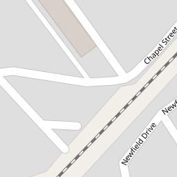
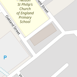

Leaflet © OpenStreetMap contributors
The heatmap indicates the level of crime in the area. The color of the heatmap indicates the crime severity and recency.
Metrics Year-on-Year
- Average area value
- 263,028.00 £Decreased by 8.14 %
- Average area rental value
- 897.00 £/moIncreased by 2.28 %
- Est rental Yield
- 4.09 %Increased by 11.14 %
- Crime Rate
- 22.00 %Unchanged by 0.00 %
from 286,322.00 £
from 877.00 £/mo
from 3.68 %
from 22.00 %
Nearby Schools
| Name | Type | Ofsted | Distance |
|---|---|---|---|
| Nelson St Philip'S Church Of England Primary School | Voluntary Aided School | Requires improvement | 0.12 KM |
| Bradley Nursery School | Local Authority Nursery School | Outstanding | 0.29 KM |
| Edenfield Girls' High School | Other Independent School | Good | 0.42 KM |
| Bradley Primary School | Community School | Good | 0.51 KM |
| Mcmillan Nursery School | Local Authority Nursery School | Requires improvement | 0.53 KM |
Images
Nearby Streets
| Name | Average Price | Average Sqft | Distance |
|---|---|---|---|
| Hey Street | £ 70,000 | 0 | 0.00 KM |
| West Rosser Court | £ 135,000 | 0 | 0.00 KM |
| Plantation Street | £ 0 | 0 | 0.00 KM |
| Cannon Street | £ 0 | 0 | 0.00 KM |
| Cumberland Street | £ 0 | 0 | 0.00 KM |
Nearby Transport
| Name | NLC | TLC | Distance |
|---|---|---|---|
| Nelson | 2565 | NEL | 0.56 KM |
| Brierfield | 2554 | BRF | 3.35 KM |
| Colne | 2562 | CNE | 3.60 KM |
| Burnley Central | 2550 | BNC | 6.28 KM |
| Burnley Manchester Road | 2549 | BYM | 7.29 KM |
Nearby Listings
| Address | Price | Type | Score | Distance |
|---|---|---|---|---|
| Chapel Street, Nelson, Lancashire, BB9 | £ 57,500 | BUY | 4 / 10 | 0.00 KM |
| Leeds Road, Nelson, Lancashire, BB9 | £ 99,950 | BUY | 5 / 10 | 0.20 KM |
| Chapel Street, Nelson, Lancashire, BB9 | £ 74,995 | BUY | 2 / 10 | 0.25 KM |
| Land off Bankhouse Road, Nelson, Lancashire, BB9 7UD | £ 1 | BUY | 7 / 10 | 0.30 KM |
| Bradley View, NELSON, Lancashire, BB9 | £ 75,000 | BUY | Unknown | 0.34 KM |
Nearby Properties
| Address | Price | Distance |
|---|---|---|
| 67 Chapel Street | £ 56,000 | 0.00 KM |
| 6 Arthur Street | £ 50,000 | 0.04 KM |
| 50 Chapel Street | £ 69,000 | 0.10 KM |
| 35 William Street | £ 57,000 | 0.10 KM |
| 98 Leeds Road | £ 65,000 | 0.13 KM |